In photos: China’s construction of military bases in Spratlys
MANILA, Philippines – Recently published satellite images of China’s land reclamation in the Spratly Islands show that they are constructing large, multi-story buildings as well as a possible airstrip and harbor that can accommodate military planes and ships.
The satellite image analysis published on Medium.com by Victor Robert Lee March 16 show the ongoing construction on reclaimed reefs in the Spratly Islands.
On the same day as the publication of the report, the Philippines filed a 3,000-page supplemental submission to the United Nations (UN) Arbitral Tribunal presenting additional arguments and information.
“The Philippines has submitted detailed responses and extensive additional information. The submission consists of 12 volumes totaling over 3,000 pages. Volume I consists of 200 pages of written argument. Volume II consists of a 200-page Atlas containing detailed information about 49 islands, reefs and other features in the South China Sea,” The Department of Foreign Affairs (DFA) said in a statement Tuesday.
BACKSTORY: UNCLOS explained: Why China’s claims in the South China Sea are invalid
The Philippines has filed for arbitration against China’s nine-dash line claim over nearly the entire South China Sea including the Spratly Islands off the coast of Palawan.
Philippines has previously filed numerous diplomatic protests over the reclamation activities of China in several reefs in the Spratlys but these were flatly rejected by China.
China has also repeatedly refused to participate in the arbitration proceedings insisting they have “indisputable sovereignty” over the entire South China Sea. They have deployed multiple Naval vessels to the area to block ships as well as fishermen from the Philippines from going to the area.
READ: China’s mischief: Expansion, reclamation
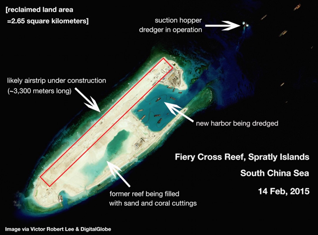
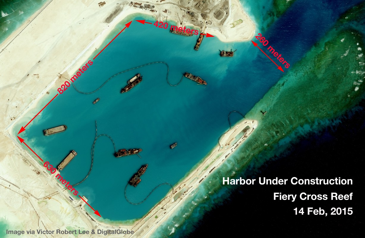
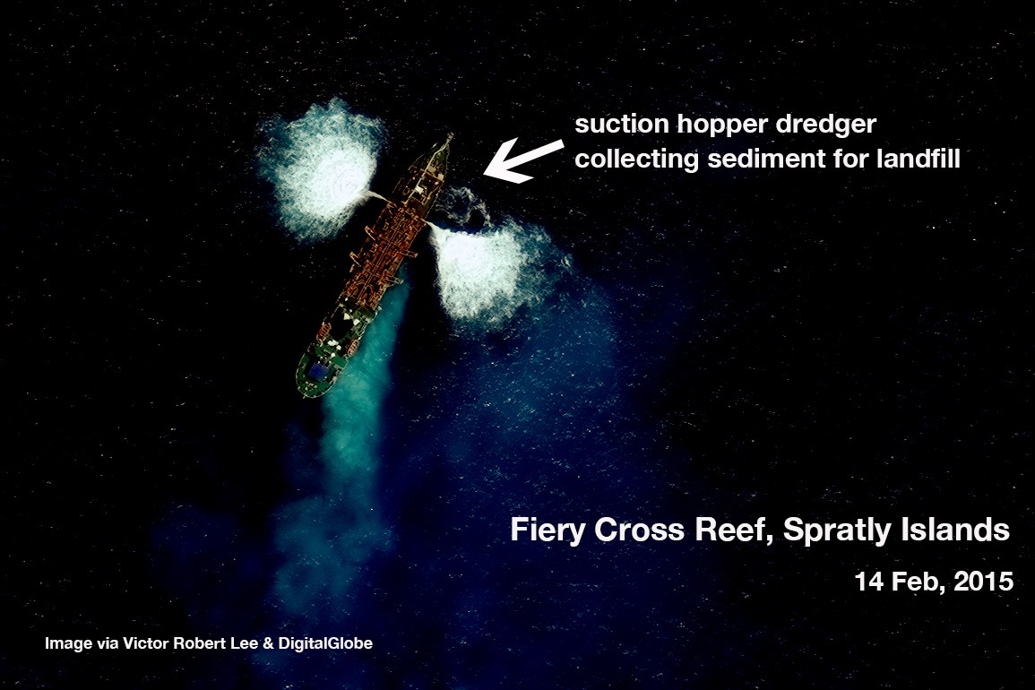
Satellite image analysis of Fiery Cross Reef (Kagitingan Reef)
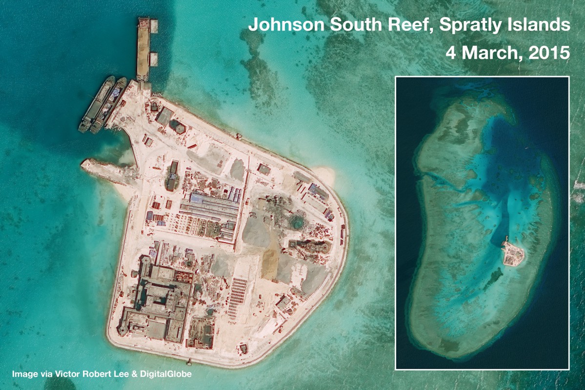
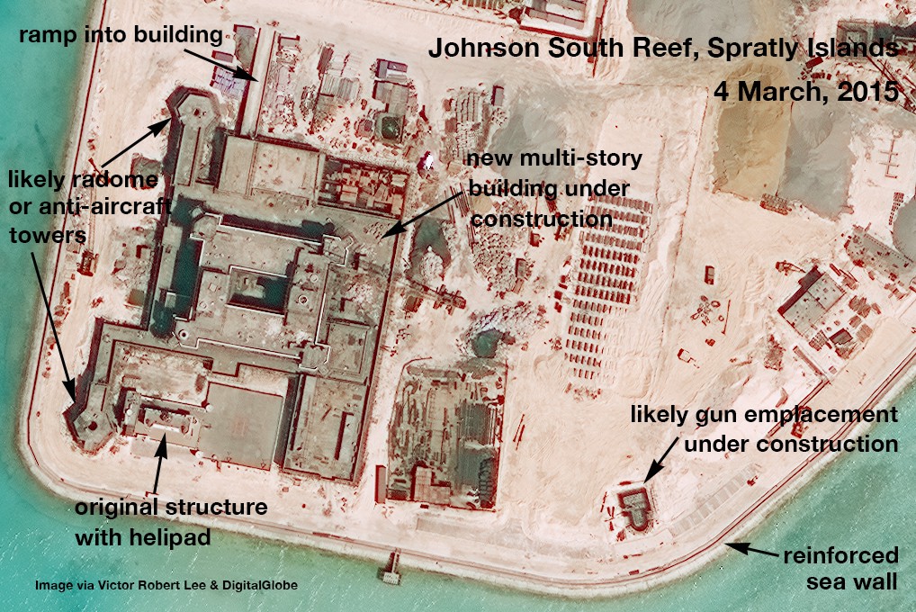
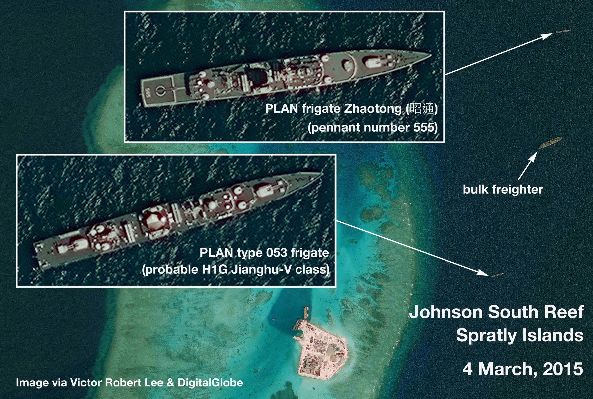
Satellite image analysis of Johnson South Reef (Mabini Reef)
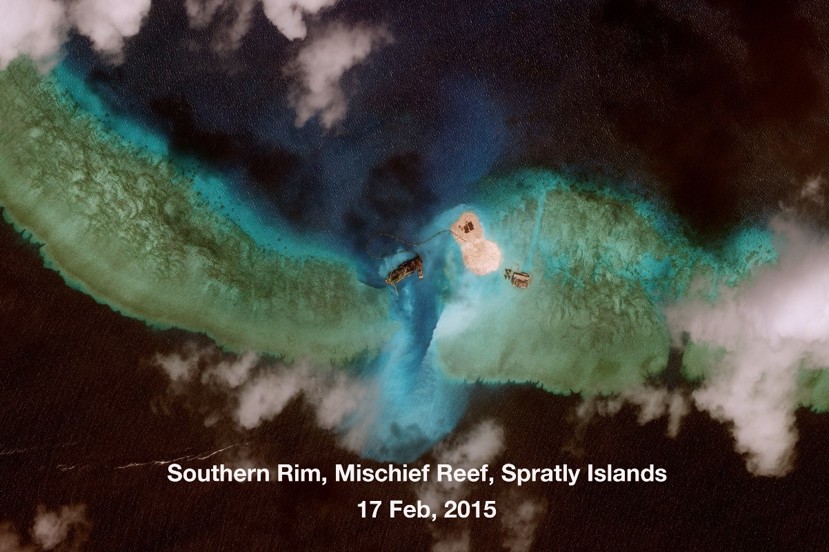
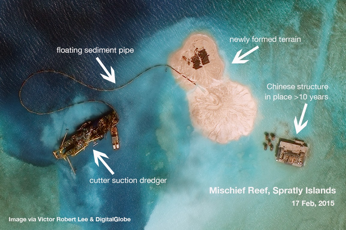
Satellite image analysis of Mischief Reef (Panganiban Reef)
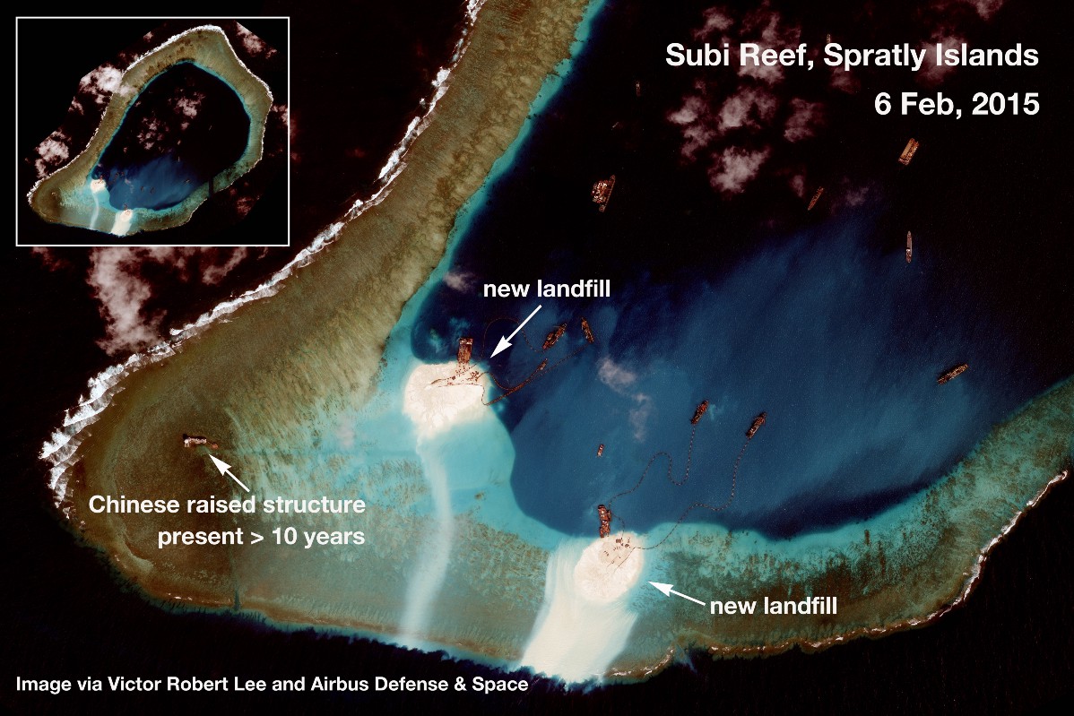
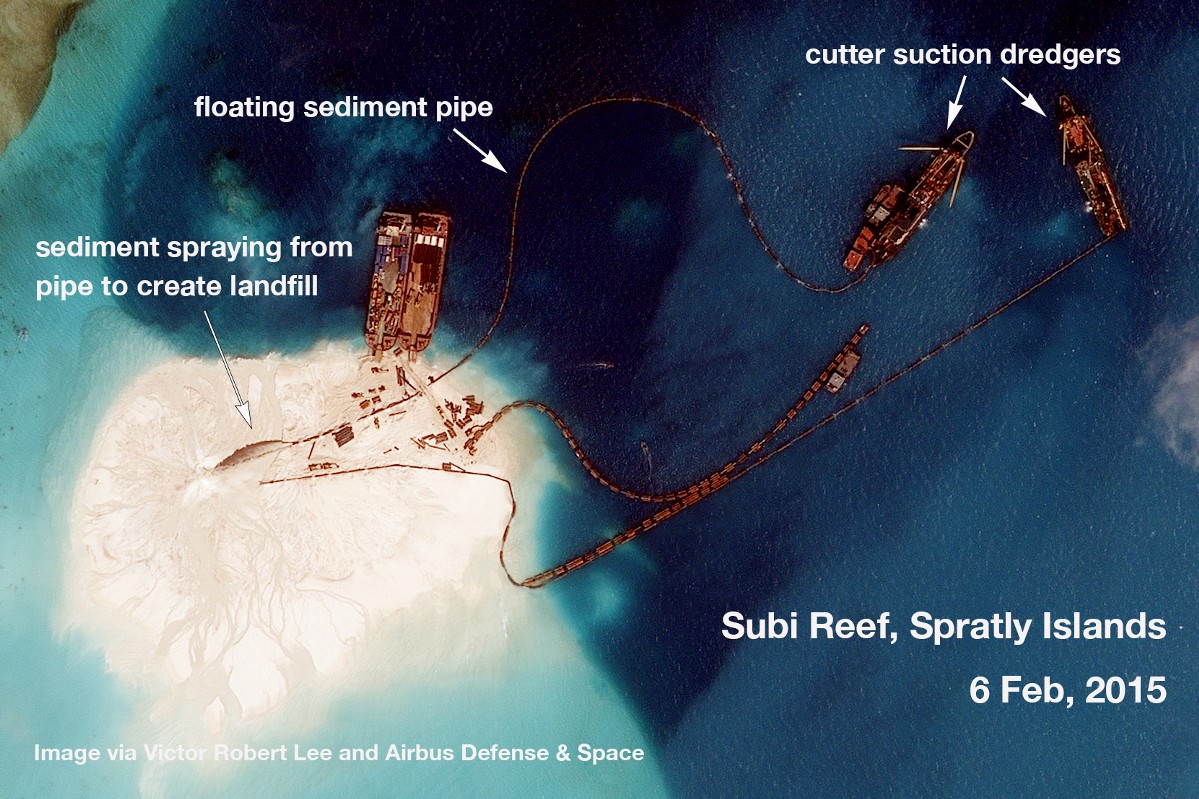
Satellite image analysis of Subi Reef (Zamora Reef)
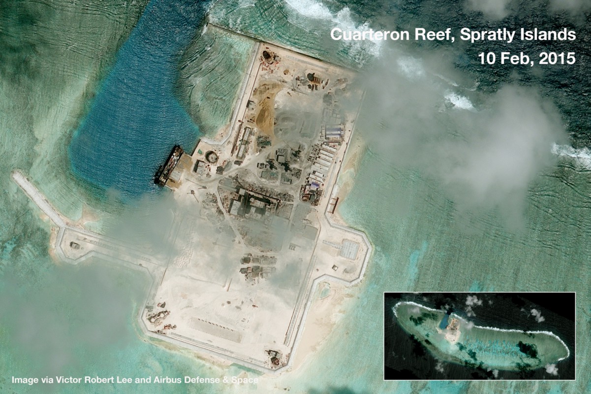
Satellite image analysis of Cuarteron Reef
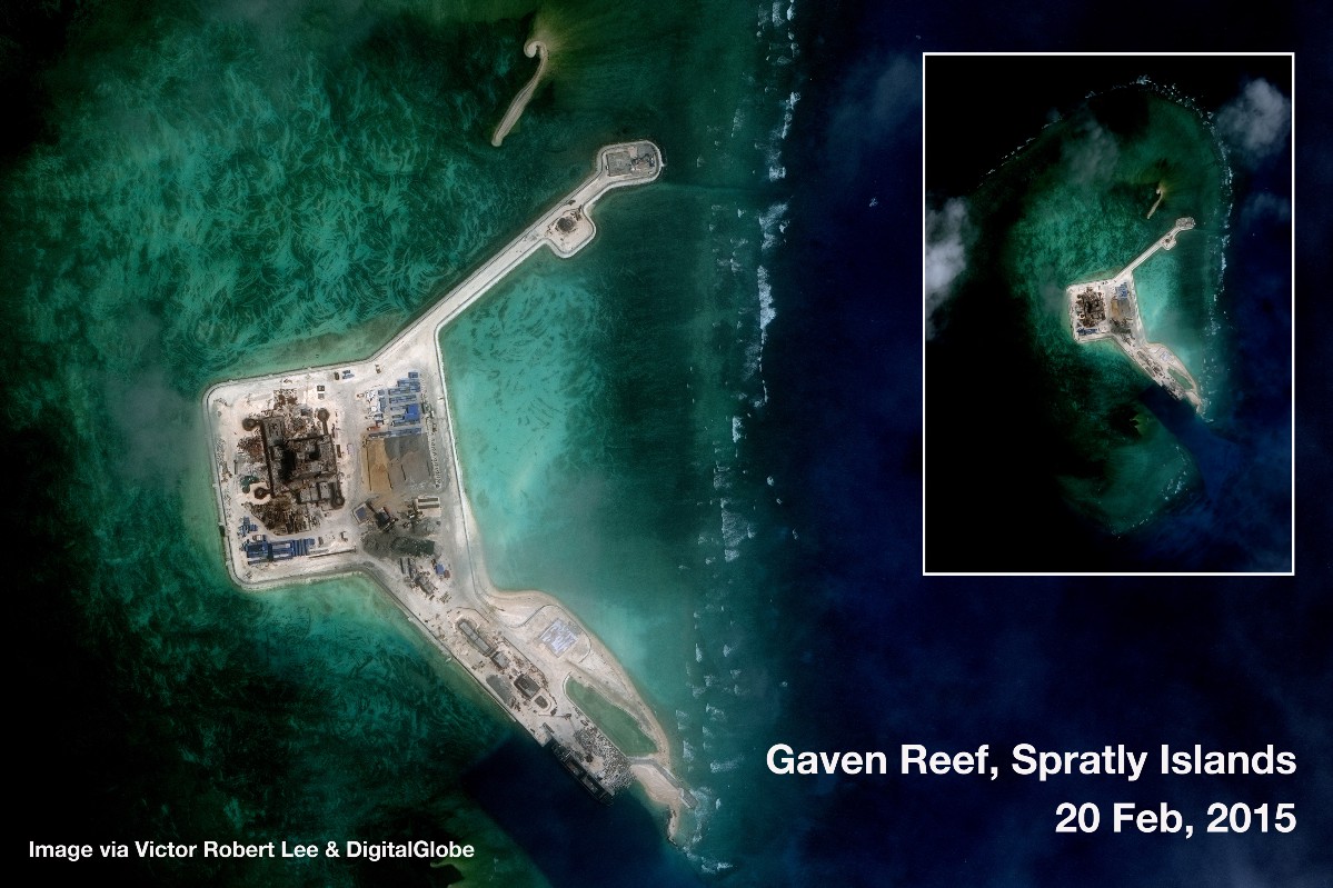
Satellite image analysis of Gaven Reef (Burgos Reef)
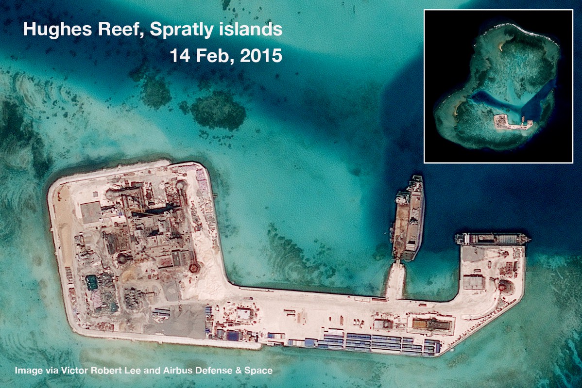
Satellite image analysis of Hughes Reef
RELATED STORIES:
Aquino asks Europe for support in South China Sea dispute with Beijing
South China Sea row endangers PH maritime industry–expert
More blockades by China to follow, say experts
60 maps debunk China’s ‘historical claim’ on South China Sea