Lawyer Anne Marie Corominas’ old maps help PH case vs China
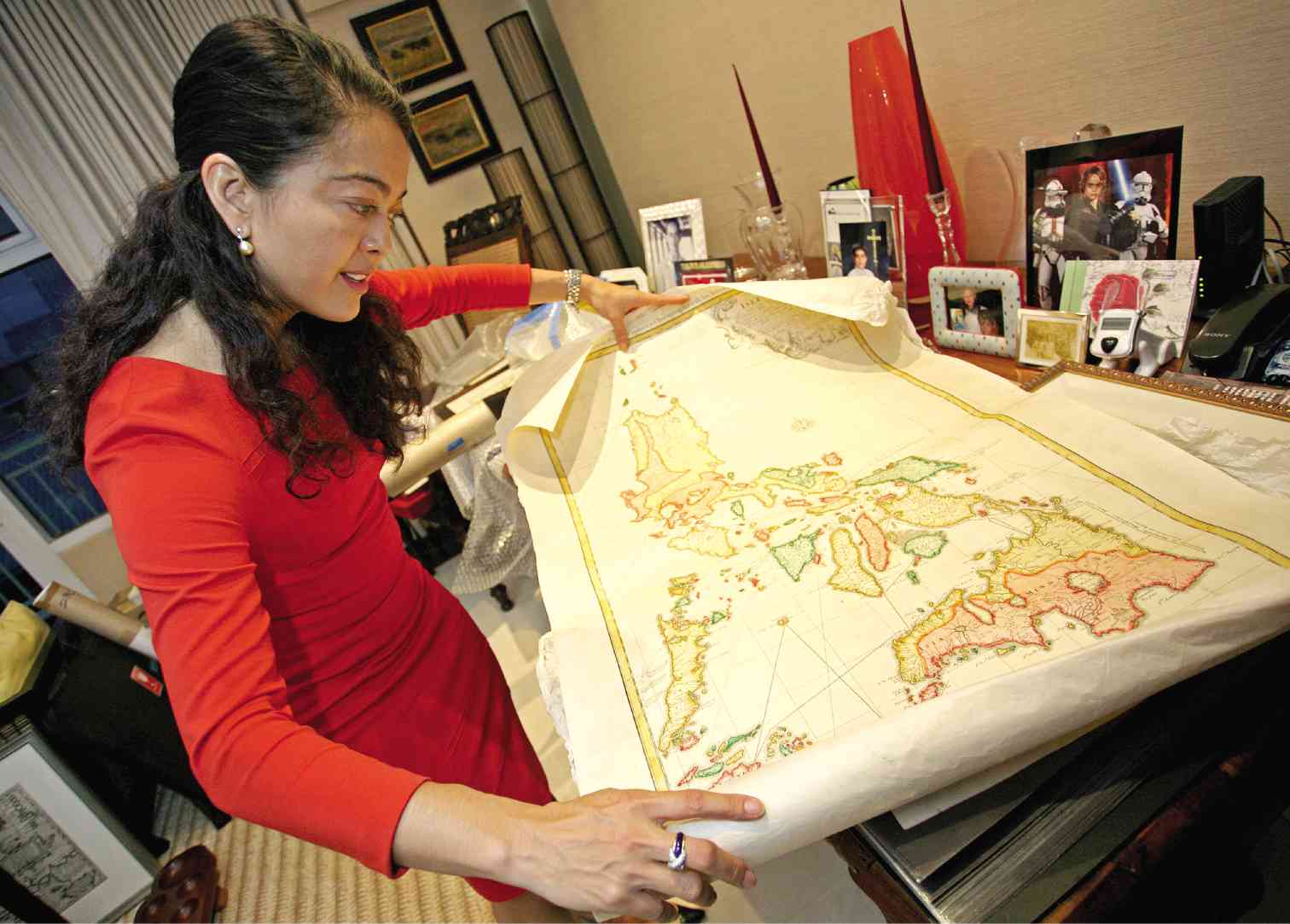
MAPPING THE TRUTH Palace lawyer Anne Marie Corominas collects maps, 5 were included in the exhibit of Justice Antonio T. Carpio who researched on China’s claim. KIMBERLY DELA CRUZ
Palace lawyer Anne Marie Corominas knows exactly where to find every ancient map of the Philippines and Asia that she has collected more than 20 years in her Makati City home.
Whether these maps are kept in acid-free binders, picture frames or tube containers usually used by architects to store their works, Corominas, who has never made an inventory of her collection, can find them in a flash.
And as typical of serious map or even art collectors, she also knows every bit of the details in each of her original maps—their design elements and all—but more important, the story that they tell of the history of the Philippines and Asia.
Who would have thought that one day her treasured map collection would be handy for the government in its territorial dispute with China in the West Philippine Sea?
Five of Corominas’ maps made it to the cartographic exhibit put up on Sept. 11 by Supreme Court Senior Associate Justice Antonio Carpio, which featured maps showing that “Panacot Shoal” or Scarborough Shoal is part of the Philippines.
She also has copies of six other maps that were in Carpio’s exhibit, titled “Historical Truths and Lies: Scarborough Shoal in Ancient Maps,” but which he had sourced from others.
Compelling argument vs China
The 60 old maps, dating from 1636 to 1940—or spanning 340 years—and were made by foreigners (including Chinese) and Filipinos, were put on display to show that China’s territorial claims to the South China Sea did not include the disputed Scarborough Shoal, which the Philippines refers to as Bajo de Masinloc or Panatag Shoal and the Chinese call Huangyan Island.
Foreign Secretary Albert del Rosario has said the maps can be used in the oral arguments in the UN arbitration tribunal when it takes up the case filed in January last year against China over its claim to almost the entire South China Sea.
Del Rosario has said Carpio’s exhibit “provides a compelling argument over China’s claim of indisputable sovereignty.”
Interestingly, Corominas, who heads the Legal and International Affairs office under Executive Secretary Paquito Ochoa Jr., with a rank of assistant secretary, also happens to be part of the government team that prepared the Philippines’ arbitration case against China.
For Corominas, who has served as legal and technical adviser to the government on issues concerning international law and who has “spearheaded and conceptualized the UN arbitration case,” this development is all “serendipity.”
Curiosity about history
Speaking to the Inquirer, Corominas said it was “curiosity” about Philippine history that drove her to look for and collect old maps of the country.
“I mean, of course you have what they teach you in school but then when you look at a map and you see this was done 300 to 400 years ago and they were able to sort of figure out what the contours were when they didn’t have an aerial view, they didn’t have Google … it fascinated me. It was a way of learning history,” Corominas said.
What she found out through collecting maps, which started when she was in law school at Ateneo de Manila University, was that because the maps were used as “navigational guides,” they were a “form of power” as they could “control information.”
Favorite map
Corominas’ favorite map is one of the five included in Carpio’s exhibit.
The map called “Insulae Philippinae Ex Autographo, Manilae” was published in 1748 in Vienna by Fernando Valdes Tamon and Leopold Kalowoda. It showed Panacot Shoal.
Corominas said she liked this map very much because it was a local map that had two Filipinos in it wearing the distinctive salakot (wide-brimmed hat) with a crocodile lying at their feet.
Carpio made a digital reproduction of the map, she said.
Corominas said she had two versions of the map, which she first saw on a cover of a catalogue from a map show in the 1990s, and which she got within a year of each other.
Corominas said most of the earlier maps she bought were priced at $800, although she does not know their value now.
No inventory
She admitted she did not know how many maps she had in her collection, not having made an inventory yet.
“It was really about the process of researching and trying to find out the history of it,” she added.
The five old Philippine maps inCarpio’s exhibit, including the six others that were in her collection but came from others, all showed “Panacot Shoal” or “Bajo de Masinloc.” The maps dated from 1748 to 1899.
Carpio in extensive research
Corominas said she was able to later “validate” her collection of Philippine and Asian maps through a book titled “Philippine Cartography” by Carlos Quirino, which was published in 1959 by the known “authority of all maps” here.
She said she knew Carpio was doing extensive research on China regarding the West Philippine Sea controversy and through his lawyer, who happened to be her friend, had offered her collection to him.
Asked on the value of the maps in the government’s case against China in the UN tribunal, Corominas said, “Maps do not necessarily say we own it.”
“Maps serve as guides or an indication, and not necessarily title,” she said.
Still, she said the maps would serve as an “inspiration for our case.”
“Our [United Nations Convention on the Law of the Sea] case is not about who owns it, but instead about maritime entitlements and whether China’s nine-dash line claim is consistent with Unclos and international law,” Corominas said.
RELATED STORIES
UNCLOS explained: Why China’s claims in South China Sea are invalid
UN tribunal ruling on sea dispute ‘will hold weight’—Palace
Filipinos aiding Chinese poachers in West Philippine Sea, says solon
For comprehensive coverage, in-depth analysis, visit our special page for West Philippine Sea updates. Stay informed with articles, videos, and expert opinions.