PH sovereignty based on Unclos, principles of international law
(Editor’s Note: The following is the position paper from the Department of Foreign Affairs on the Philippine standoff with China at Panatag Shoal, also known as Bajo de Masinloc and Scarborough Shoal, in the West Philippine Sea.)
Article continues after this advertisementBajo de Masinloc is an integral part of the Philippine territory. It is part of the Municipality of Masinloc, Province of Zambales. It is located 124 nautical miles (220 kilometers) west of Zambales and is within the 200- nautical-mile (370 kilometers) exclusive economic zone (EEZ) and Philippine continental shelf.
Article continues after this advertisementA Philippine Navy surveillance aircraft, patrolling the area to enforce the Philippine Fisheries Code and marine environment laws, spotted eight Chinese fishing vessels anchored inside the Bajo de Masinloc (Panatag Shoal) on Sunday, April 8, 2012. On April 10, the Philippine Navy sent the BRP Gregorio del Pilar to the area. In accordance with established rules of engagement, an inspection team was dispatched and it reported finding large amounts of illegally collected corals, giant clams and live sharks in the compartments of the Chinese fishing vessels.
The actions of the Chinese fishing vessels are a serious violation of the Philippines’ sovereignty and maritime jurisdiction. The poaching of endangered marine resources is a violation of the Fisheries Code and the Convention on International Trade in Endangered Species of Wild Flora and Fauna (CITES).
Basis of sovereignty
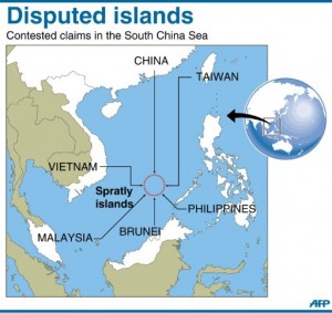
Bajo de Masinloc (international name, Scarborough Shoal) is not an island. Bajo de Masinloc is also not part of the Spratlys.
Bajo de Masinloc is a ring-shaped coral reef, which has several rocks encircling a lagoon. About five of these rocks are above water during high tide. Some of these rocks are about three meters high and can be seen above the water. The rest of the rocks and reefs are submerged during high tide.
Bajo de Masinloc’s chain of reefs and rocks is about 124 nautical miles (220 km) from the nearest coast of Luzon and approximately 472 nautical miles (850 km) from the nearest coast of China. Bajo de Masinloc is located approximately along latitude 15°08’N and longitude 117°45’E. The rocks of Bajo de Masinloc are situated north of the Spratlys.
Obviously then the rocks of Bajo de Masinloc are also within the 200 nautical mile EEZ and the 200 nautical mile continental shelf of the Philippines.
Distinction
A distinction has to be made between the rocks of Bajo de Masinloc and the larger body of water and continental shelf where the geological features are situated. The rights or nature of rights of the Philippines over Bajo de Masinloc are different from the rights it exercises over the larger body of water and continental shelf.
The Philippines exercises full sovereignty and jurisdiction over the rocks of Bajo de Masinloc, and sovereign rights over the waters and continental shelf where the rocks of Bajo de Masinloc are situated.
The basis of Philippine sovereignty and jurisdiction over the rocks of Bajo de Masinloc is distinct from that of its sovereign rights over the larger body of water and continental shelf.
A. Public international law
The rocks of Bajo de Masinloc are Philippine territory.
The basis of Philippine sovereignty and jurisdiction over the rocks is not premised on the cession by Spain of the Philippine archipelago to the United States under the Treaty of Paris. That the rocks of Bajo de Masinloc are not included or within the limits of the Treaty of Paris, as alleged by China, is therefore immaterial and of no consequence.
Philippine sovereignty and jurisdiction over the rocks is likewise not premised on proximity or the fact that the rocks are within its 200 nautical mile EEZ or continental shelf under the UN Convention on the Law of the Sea (Unclos). Although the Philippines necessarily exercises sovereign rights over its EEZ and continental shelf, the reason why the rocks of Bajo de Masinloc are Philippine territory is anchored on other principles of public international law.
As decided in a number of cases by international courts or tribunals, most notably the Palmas Island Case, a mode for acquiring territorial ownership over a piece of real estate is effective exercise of jurisdiction. In the Palmas case, sovereignty over the Palmas Island was adjudged in favor of the Netherlands on the basis of “effective exercise of jurisdiction” although the island may have been historically discovered by Spain and historically ceded to the United States in the Treaty of Paris.
In the case of Bajo de Masinloc, the Philippines, since it gained independence, has exercised both effective occupation and effective jurisdiction over Bajo de Masinloc.
The name Bajo de Masinloc (which means Shallows of Masinloc or Masinloc Shoal) itself identifies the shoal as a particular political subdivision of the Philippine province of Zambales, known as Masinloc.
Maps
One of the earliest known and most accurate maps of the area, named Carta Hydrographical y Chorographica de las Yslas Filipinas by Fr. Pedro Murillo Velarde, SJ, and published in 1734, showed Bajo de Masinloc as part of Zambales.
The name Bajo de Masinloc was given to the shoal by the Spanish colonizers. In 1792, another map, drawn by the Alejandro Malaspina expedition and published in 1808 in Madrid, Spain, also showed Bajo de Masinloc as part of Philippine territory. This map showed the route of the Malaspina expedition to and around the shoal. It was reproduced in the Atlas of the 1939 Philippine Census.
The Mapa General, Islas Filipinas, Observatorio de Manila published in 1990 by the US Coast and Geodetic Survey, also showed Bajo de Masinloc as part of the Philippines.
Philippine flags have been erected on some of the islets of the shoal, including a flag raised on an 8.3-meter high flag pole in 1965 and another Philippine flag raised by Congressmen Roque Ablan and Jose Yap in 1997. In 1965, the Philippines built and operated a small lighthouse on one of the islets in the shoal. In 1992, the Philippine Navy rehabilitated the lighthouse and reported it to the International Maritime Organization for publication in the List of Lights (currently this lighthouse is not working).
Bajo de Masinloc was also used as target range by Philippine and US naval forces stationed in Subic Bay in Zambales. The Philippines’ Department of Environment and Natural Resources together with the University of the Philippines has also been conducting scientific, topographic, and marine studies in the shoal. Filipino fishermen have always considered the shoal their fishing grounds because of its proximity to the coast of southwest Luzon.
Archipelagic baselines
In 2009, when the Philippines passed an amended Archipelagic Baselines Law fully consistent with Unclos, Bajo de Masinloc was classified under the “Regime of Islands” consistent with the Law of the Sea.
“Section 2. The baseline in the following areas over which the Philippines likewise exercises sovereignty and jurisdiction shall be determined as “Regime of Islands” under the Republic of the Philippines consistent with Article 121 of the Unclos:
a) The Kalayaan Island Group as constituted under Presidential Decree No. 1596; and
b) Bajo de Masinloc, also known as Scarborough Shoal.”
Comments on Chinese claims
Question:
But what about the historical claim of China over Bajo de Masinloc (Scarborough Shoal)? Does China have superior right over Bajo de Masinloc on the basis of its so-called historical claim? China is claiming Bajo de Masinloc based on historical arguments, claiming it to have been discovered by the Yuan Dynasty. China is also claiming that Bajo de Masinloc has been reflected in various official Chinese maps and has been named by China in various official documents.
Answer:
Chinese assertions based on historical claims must be substantiated by a clear historic title. It should be noted that under public international law, historical claims are not historical titles. A claim by itself, including historical claim, could not be a basis for acquiring a territory.
Under international law, the modes of acquiring a territory are: discovery, effective occupation, prescription, cession and accretion. Also, under public international law, for a historical claim to mature into a historical title, a mere showing of long usage is not enough.
Other criteria have to be satisfied, such as that the usage must be open, continuous, adverse or in the concept of an owner, peaceful and acquiesced by other states. Mere silence by other states to one’s claim is not acquiescence under international law. Acquiescence must be affirmative such that other states recognize the claim as a right on the part of the claimant that other states ought to respect as a matter of duty. There is no indication that the international community has acquiesced to China’s so-called historical claim.
Naming and placing on maps are also not bases in determining sovereignty. In international case law relating to questions of sovereignty and ownership of land features, names and maps are not significant factors in the determination of international tribunals’ determination of sovereignty.
Question:
What about China’s claims that Bajo de Masinloc is traditional fishing waters of Chinese fishermen?
Answer:
Under international law, fishing rights are not a mode of acquiring sovereignty (or even sovereign rights) over an area. Neither could it be construed that the act of fishing by Chinese fishermen is a sovereign act of a state nor can it be considered a display of state authority. Fishing is an economic activity done by private individuals. For occupation to be effective there has to be clear demonstration of the intention and will of a state to act as sovereign and there has to be peaceful and continuous display of state authority, which the Philippines has consistently demonstrated.
Besides, when Unclos took effect, it has precisely appropriated various maritime zones to coastal states, eliminating so-called historical waters and justly appropriating the resources of the seas to coastal states to which the seas are appurtenant. “Traditional fishing rights” is in fact mentioned only in Article 51 of Unclos, which calls for archipelagic states to respect such rights, if such exist, in its archipelagic waters.
It should also be noted, that in this particular case, the activities of these so-called fishermen can be hardly described as fishing. The evidence culled by the Philippine Navy showed clearly that these are poaching, involving the harvesting of endangered marine species, which is illegal in the Philippines and illegal under international law, specifically the CITES.
B. Basis of sovereign rights
As earlier indicated, there is a distinction between the rocks of Bajo Masinloc and the waters around them. The question of ownership of the rocks is governed by the principles of public international law relating to modes for acquiring territories. On the other hand, the extent of its adjacent waters is governed by Unclos. The waters outside of the maritime area of Bajo de Masinloc are also governed by Unclos.
As noted, there are only about five rocks in Bajo de Masinloc that are above water during high tide. The rest are submerged during high tide. Accordingly, these rocks have only 12 nautical miles maximum territorial waters under Article 121 of Unclos. Since the Philippines has sovereignty over the rocks of Bajo de Masinloc, it follows that it has also sovereignty over their 12 nautical miles territorial waters.
Question:
But what about the waters outside the 12 nautical miles territorial waters of the rocks of Bajo de Masinloc, what is the nature of these waters including the continental shelves? Which state has sovereign rights over them?
Answer:
As noted, Bajo de Masinloc is located approximately at latitude 15°08’N and longitude 117°45’E. It is approximately 124 nautical miles off the nearest coast of Zambales. Clearly, the rocks of Bajo de Masinloc are within the 200 nautical miles EEZ and continental shelf of the Philippines.
Therefore, the waters and continental shelves outside of the 12 nautical miles territorial waters of the rocks of Bajo de Masinloc appropriately belong to the EEZ and continental shelf of the Philippines. As such, the Philippines exercises exclusive sovereign rights to explore and exploit the resources within these areas to the exclusion of other countries under Unclos. Part V of Unclos, specifically provides that the Philippines exercises exclusive sovereign rights to explore, exploit, conserve and manage resources whether living or nonliving, in this area. Although other states have the right of freedom of navigation over these areas, such rights could not be exercised to the detriment of the internationally recognized sovereign rights of the Philippines to explore and exploit the resources in its 200 nautical miles EEZ and continental shelf. To do otherwise would be in violation of international law, specifically Unclos.
Therefore, the current action of the Chinese surveillance vessels within the Philippine EEZ is obviously inconsistent with its right of freedom of navigation and in violation of the sovereign rights of the Philippines under Unclos. It must also be noted that the Chinese fishermen earlier apprehended by Philippine law enforcement agents may have poached not only in Bajo de Masinloc but likely also in the EEZ of the Philippines. Therefore, these poachers have violated the sovereign rights of the Philippines under Unclos.
PH archeological vessel
The Philippine National Museum has been undertaking an official marine archaeological survey in the vicinity of Bajo de Masinloc.
The archaeological survey is being conducted by the Philippine National Museum on board the Philippine-flag MY Saranggani.
Chinese maritime surveillance vessels have been harassing the MY Saranggani. The Philippines has strongly protested the harassments by the Chinese side. The actions by the Chinese vessels are in violation of the sovereign right and jurisdiction of the Philippines to conduct marine research or studies in its EEZ.
Endangered species
The Philippine Navy, during a routine sovereignty patrol, saw eight fishing vessels moored at Bajo de Masinloc on April 10. The Philippine side inspected the vessels and discovered that they were Chinese fishing vessels and on board were illegally obtained endangered corals and giant clams in violation of the Philippine Fisheries Code
The Philippines staunchly protects its marine environment from any form of illegal fishing and poaching. It is a state party to the CITES and Convention on Biological Diversity.
This illicit activity has also undermined the work of the Philippine government as a member of the Coral Triangle Initiative.
The coral colonies in Bajo de Masinloc have been in existence for centuries.
Current situation
The Philippines is committed to the process of consultations with China toward a peaceful and diplomatic solution to the situation.
As the Department of Foreign Affairs works toward a diplomatic solution, the Philippine Coast Guard is in the area and is continuing to enforce relevant Philippine laws.