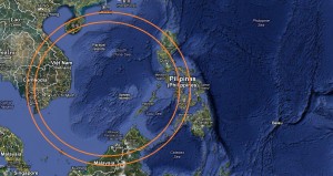
China’s National Administration of Surveying, Mapping and Geoinformation (NASMG), which announced the release of the map on Friday, described the new official map as featuring “more than 130 islands and islets in the South China Sea, most of which have not been featured on previous maps of China,” the Xinhua report said.
The Department of Foreign Affairs (DFA) said it would ask the Philippine Embassy in Beijing to confirm the report.
“We will ask our embassy in Beijing to verify the reported official map of China and the extent of its coverage in the South China Sea before making our comment on it,” said Assistant Secretary Raul Hernandez, the DFA spokesperson.
The Philippines is also known to be drafting its own map officially renaming the South China Sea the West Philippine Sea and including within its exclusive economic zone the islands in the disputed waters that it claims as part of Philippine territory—the Kalayaan island group in the disputed Spratlys chain and the Panatag (Scarborough) Shoal.
China’s new vertical format map was published by China’s Sinomaps Press and copies are expected to be made available to the Chinese public by the end of the month, Xinhua said.
“The maps will be very significant in enhancing the Chinese people’s awareness of national territory, safeguarding China’s marine rights and interests, and manifesting China’s political diplomatic stance,” Sinomaps chief editor Xu Gencai was quoted as saying in the Xinhua report.
Zhou Beiyan, editor of the new Chinese maps, said the old official maps featured only the Spratlys (called Nansha by China), Paracels (Xisha) and Macclesfield Bank (Zhongsha) in the disputed waters.
By comparison, the new vertical map makes clear the delineations of the South China Sea islands and “demonstrates their geographic relations to surrounding island countries as well as surrounding islands and islets.”
The map’s bottom-left corner features an illustration of the Diaoyu, or Senkaku, Islands territories being claimed by China and Japan, according to the Xinhua report.
China claims ownership of almost all of the resource-rich territories in the South China Sea, conflicting with the partial claims of the Philippines, Vietnam, Brunei, Malaysia and Taiwan.
Last year, China issued new chip-embedded passports bearing a Chinese map that includes within China’s sovereign domain the disputed West Philippine Sea territories.
Protesting this “excessive declaration” of Chinese territory, the Philippines refused to stamp visas on the Chinese e-passports, issuing the visas on separate forms for the Chinese passport holders.


