La Niña arrives in Singapore but may not have cooling effect

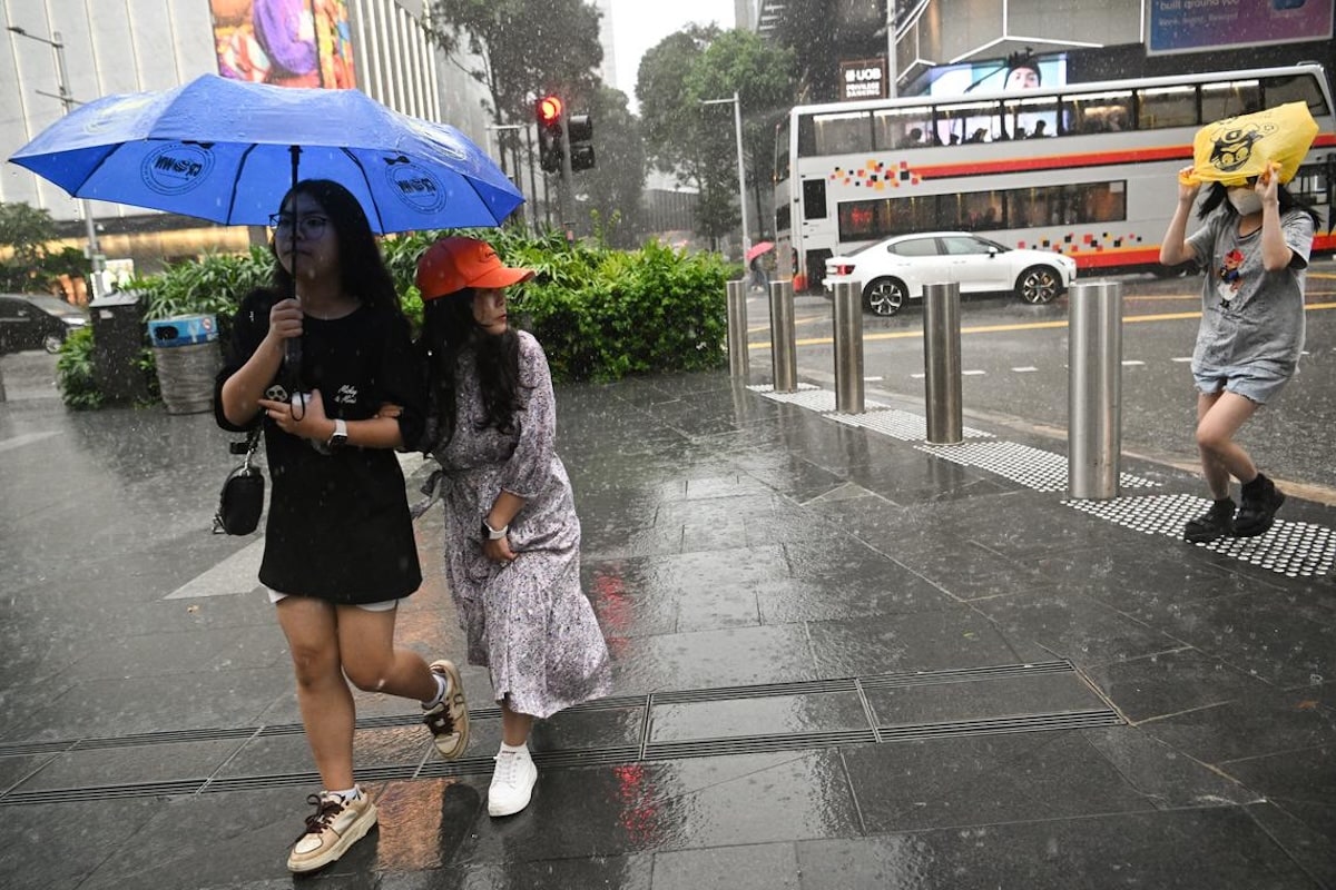
A La Nina event typically results in more rain over Singapore as trade winds bring moisture and rainfall. The Straits Times/Asia News Network
SINGAPORE – The weatherman in early February declared the onset of La Niña, a climate phenomenon that often brings rain and cooler weather to Singapore.
But the cooling effect will not be as pronounced due to the longer-term warming trend, the Meteorological Service Singapore (MSS) told The Straits Times.
Due to global warming, recent March to May temperatures – among the warmest months in Singapore – associated with La Niña are still higher than those associated with the warming El Nino phenomenon 40 years ago, said MSS.
READ: What looming La Niña means for global temperatures
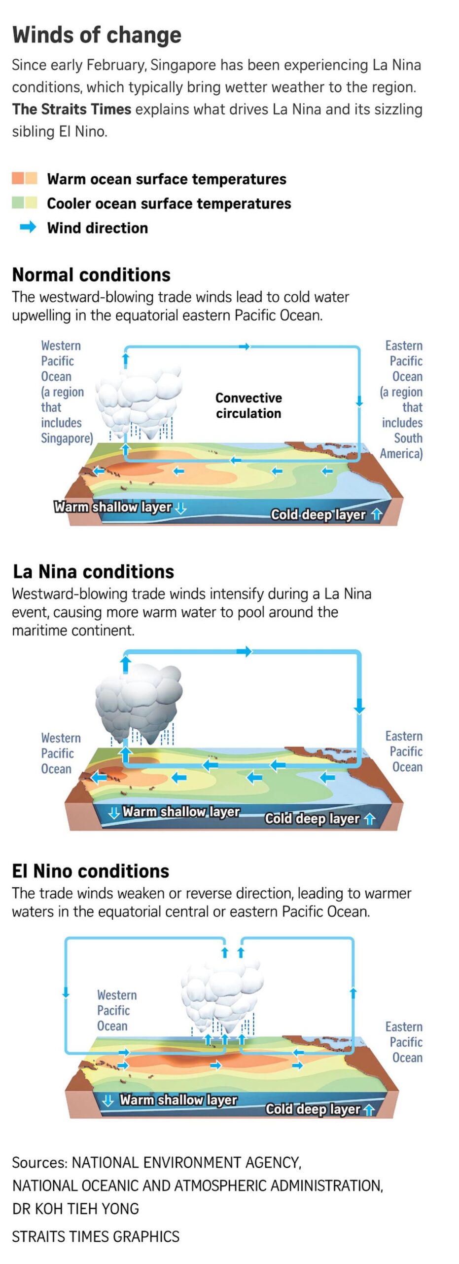
El Niño typically brings drier, hotter conditions to Southeast Asia and Australia, while La Niña usually brings wetter and cooler conditions.
They alternate every few years and, together, the two phases are known as the El Niño-Southern Oscillation (Enso).
Enso is a global natural climate cycle involving changes in winds and sea surface temperatures over the tropical Pacific Ocean, the largest ocean basin in the world.
During a La Niña event, winds that blow from east to west across the tropical Pacific Ocean get stronger. These winds are called trade winds.
READ: La Niña’s waning impact on global warming
More shallow warm water pools up in the western Pacific Ocean, which includes Southeast Asia.
This typically results in more rain over Singapore as the winds bring moisture and rainfall to the area.
La Niña conditions are considered established based on several indicators like sea surface temperatures, trade winds and cloudiness over the tropical Pacific region, said MSS, which is under the National Environment Agency.
This episode is predicted to last till April or May, after which neutral conditions are expected to set in when neither phenomenon is happening.
During and just after La Niña, the highest and average daily temperatures tend to be lower, but high temperatures can still occur, said MSS.
For example, in the last La Niña event that extended into the start of 2023, the mercury peaked at 37 deg C on May 13, a level not seen since 1983.
El Nino typically brings drier, hotter conditions to South-east Asia and Australia, while La Nina usually brings wetter and cooler conditions. FILE PHOTO: The Straits Times/Asia News Network
Dr Koh Tieh Yong, from the World Climate Research Program, said the current La Niña episode is weak, which means other regional weather influences may easily overpower the impact of the phenomenon.
“The local weather may manifest within the normal range of variability – wetter or drier, cooler or warmer – as though the La Niña did not happen,” added Dr Koh, who co-chairs the Asian-Australian monsoon working group under the program.
La Niña is a climate phenomenon, but there are other drivers of weather in Singapore.
The Republic is currently in the dry phase of the north-east monsoon, which typically ends around early March.
From late March to May, the inter-monsoon period sets in, when afternoon thunderstorms can be common.
MSS noted that on average, during the end of the north-east monsoon and the inter-monsoon period, Singapore experiences slightly higher rainfall during La Niña events compared with El Niño events.
However, this differs from year to year.
Some of the wettest February-to-March periods have occurred during times when neither of the climate phenomena was occurring, added MSS.
Globally, the current La Niña conditions were fully established only in December 2024, which is a relatively late start.
MSS explained that this is likely because the trade winds were unfavorable and slowed the cooling of the shallow top layer of water in the eastern Pacific, near South America.
“Thus, the manifested La Niña is presently expected to be short-lived if no random weather event occurs by April or May (to strengthen it),” added Dr Koh.
The previous La Nina episode between 2020 and early 2023 was particularly prolonged. In 2022, Singapore saw the wettest October in more than 40 years, clocking 412mm of rainfall.
Even so, the annual temperature in 2022 was the 10th highest since temperature records began in 1929.
After the inter-monsoon season ends around May, a second monsoon season – the southwest monsoon – occurs from June to September.
During this period, winds typically approach from the south-east and blow towards the north-east.
The south-west monsoon is generally a drier season for the region compared with other times of the year.
But there is still a chance of a wetter-than-average south-west monsoon season in 2025 as Singapore’s rainfall is affected by other large-scale climate drivers, as well as day-to-day variations in the weather, noted MSS.
“There is also a small possibility that La Niña conditions could persist or redevelop in the second half of 2025,” added the national meteorological service.