Scientists document lost mountain cities on Silk Road in Uzbekistan

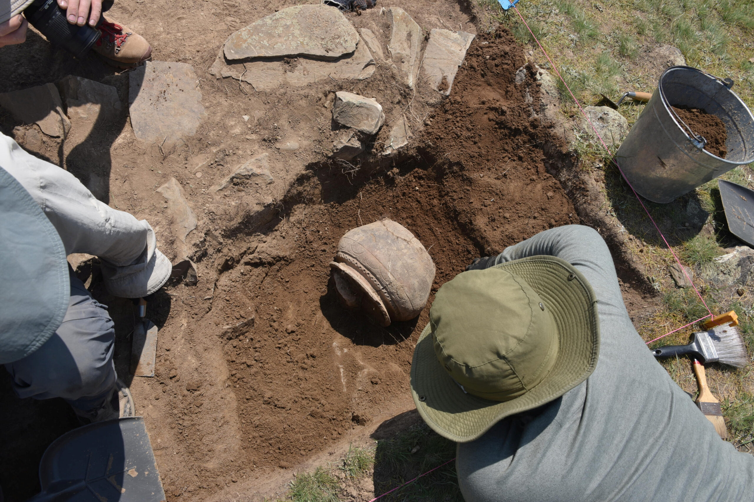
Researchers excavate medieval pottery at the newly rediscovered medieval Silk Road city Tugunbulak located in the mountains of southeastern Uzbekistan June 8, 2022 Michael Frachetti/Handout via REUTERS
TASHKENT — In the mountains of Uzbekistan, archaeologists aided by laser-based remote-sensing technology have identified two lost cities that thrived along the fabled Silk Road trade route from the 6th to 11th centuries AD – the bigger one a center for the metal industry and the other reflecting early Islamic influence.
The fortified highland cities, located three miles (5 km) apart at around 6,560-7,220 feet (2,000-2,200 meters) above sea level, are among the largest known from the mountainous sections of the Silk Road, the sprawling web of overland trade routes linking Europe and the Middle East to East Asia.
“These cities were completely unknown. We are now working through historical sources to find possible undiscovered places that match our findings,” said archaeologist Michael Frachetti of Washington University in Saint Louis, lead author of the study published in the journal Nature.
READ: ‘Disappeared completely’: melting glaciers worry Central Asia
The bigger of the two, called Tugunbulak, covered about 300 acres (120 hectares), with a population perhaps in the tens of thousands, the researchers said. It was one of the largest cities of its time in its region of Central Asia, rivaling even the famed trade hub Samarkand situated about 70 miles (110 km) away. It existed from around 550 to 1000 AD.
Article continues after this advertisement“Tugunbulak is many times larger and more enigmatic than other highland castles or settlements that have been documented in high-elevation Central Asia,” Frachetti said.
Article continues after this advertisementThe other city, Tashbulak, was only a tenth the size of its neighbor, with a population perhaps in the thousands, the researchers said, lasting from around 730-750 to 1030-1050 AD.
Founded in early medieval times in what is now southeastern Uzbekistan, the cities were eventually abandoned and forgotten until archaeologists came across the first evidence of them while scouring a rugged mountain area, with deep ravines, steep ridge lines and forests. They deployed drone-based lidar remote scanning to map the scale and layout of the sites.
READ: Climate change fueling disappearance of Central Asia’s Aral Sea
“Lidar is a technology that floods the landscape with lasers to measure the topography, in this case, in highly refined detail,” Frachetti said.
It revealed evidence of numerous structures, plazas, fortifications, roads, habitations and other urban features.
Preliminary excavation at one of Tugunbulak’s fortified buildings – girded by thick earthen walls – yielded the remains of kilns and furnaces, indicating it was a factory where metalsmiths may have turned rich local deposits of iron ore into steel.
The researchers are working to confirm steel was made there by chemically analyzing slag – a byproduct of iron and steel production – found at the site. The region in the 9th and 10th centuries was known for steel production.
The metal industry may have been a central feature of Tugunbulak’s economy, along with trade in animals such as sheep and cattle and animal products including wool, Frachetti said.
“Tugunbulak in particular complicates much of the historical understanding of the early medieval political economy of the Silk Routes, placing both political power and industrial production far outside the regional ‘breadbaskets’ such as Samarkand,” Frachetti said.
Tashbulak lacked the industrial scale of Tugunbulak but boasted an interesting cultural feature – a large cemetery that reflects the early spread of Islam in the region. Its 400 graves – for men, women and children – include some of the oldest Muslim burials documented in the region.
“The cemetery is mismatched to the small size of the town. There’s definitely something ideologically oriented around Tashbulak that has people being buried there,” Frachetti said.
Islam arose on the Arabian Peninsula in the 7th century and rapidly spread in the successive centuries.
The Silk Road enabled economic, cultural, religious and political exchanges between East and West, as the caravans that traversed its pathways toted not only a panoply of products but also people and ideas. It linked cosmopolitan Chinese cities such as Xi’an to destinations including the Byzantine capital Constantinople and the sophisticated Islamic metropolis Baghdad.
Tugunbulak and Tashbulak are especially remarkable given their altitude, roughly comparable to the later Inca citadel of Machu Picchu in Peru.
“The key finding of this study is the existence of large, fortified and planned cities at high elevation, which is still a rare occurrence but is much more exceptional in ancient times,” Frachetti said.