Supercharged storms: how climate change amplifies cyclones

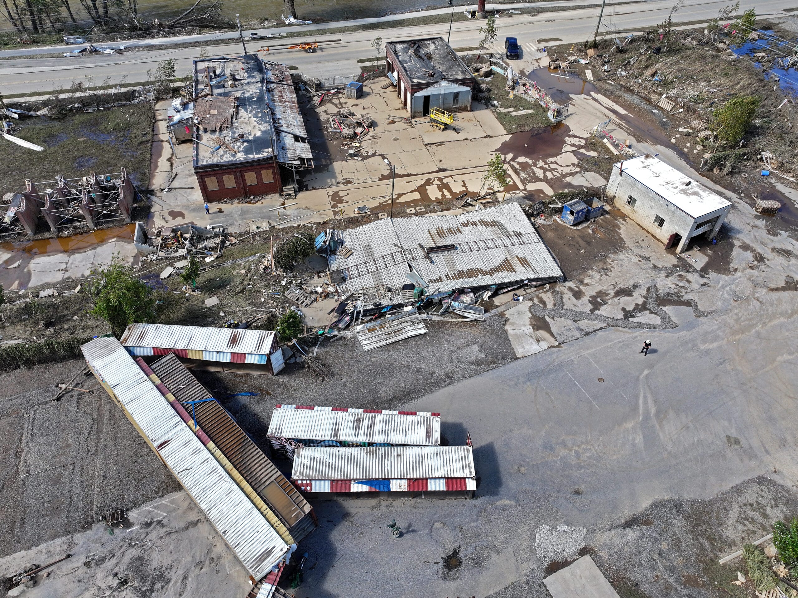
An aerial view of a person (RIGHT C) standing near debris in the aftermath of Hurricane Helene flooding on October 2, 2024 in Asheville, North Carolina. President Joe Biden will take an aerial tour of the devastated region today and has ordered the deployment of 1,000 active duty U.S. soldiers to assist with storm relief efforts and reinforce the North Carolina National Guard. Agence France-Presse
WASHINGTON — From Hurricane Helene to Typhoon Yagi, powerful storms are battering the globe, and scientists warn that a warming planet is amplifying their destructive force to unprecedented levels.
Here’s what the latest research reveals about how climate change is supercharging tropical cyclones — the generic term for both weather phenomenon.
Packing more punch
First, the basics: warmer ocean surfaces release more water vapor, providing additional energy for storms, which intensifies their winds. A warming atmosphere also allows them to hold more water, boosting heavy rainfall.
READ: Has the planet’s climate gone haywire?
“On average, the destructive potential of hurricanes has increased about 40 percent due to the 1 degrees Celsius (roughly 2 degrees Fahrenheit) warming that has already taken place,” Michael Mann, a climatologist at University of Pennsylvania, told AFP.
In a recent paper in the Proceedings of the National Academy of Sciences (PNAS), Mann added his voice to calls for the Saffir-Simpson scale to be expanded to include a “new class of monster storms” — Category 6, where sustained winds exceed 192 miles per hour (308 kph).
According to experts, climate change set the stage for Helene, which peaked as a Category 4 hurricane.
“The oceanic heat content was at a record level, providing plenty of fuel and potential for a storm like this to gain strength and become a large and very damaging storm,” David Zierden, Florida’s state climatologist, told AFP.
Rapid intensification
“Rapid intensification,” defined as a hurricane speeding up by 30 knots within a 24-hour period, is also becoming more common.
READ: Explainer: How climate change is making the world sick
“If intensification happens very close to the coast in the lead up to landfall, it can have a huge effect, which you saw last week in the case of Helene,” Karthik Balaguru, a climate scientist at the Department of Energy’s Pacific Northwest National Laboratory, told AFP.
Balaguru was the lead author on a paper this year in journal Earth’s Future that used decades of satellite data to show “a robust increase in the rates at which storms intensified close to the coast, and this is across the world.”
The explanation is two-fold.
Warming climate patterns are reducing wind shear — changes in wind speed and direction with height — along both the Atlantic Coast of North America and the Pacific Coast of Asia.
“When you have strong wind shear, it tends to tear apart the core of the storm,” explained Balaguru.
Climate change is also driving higher humidity along coastlines compared to the open ocean.
This is likely due to a thermal gradient created as land heats faster than water, causing changes in pressure and wind circulation that push moisture into the mid-troposphere where storms can access it. More data is needed to confirm this hypothesis.
Additionally, rising sea levels — about a foot over the past century — mean cyclones are now operating from a higher baseline, amplifying storm surges, said Zierden.
How often?
While the impact of climate change on how often cyclones happen is still an active area of research, studies suggest it can either increase or decrease frequency, depending on the region.
Particle pollution generated by industry, vehicles, and the energy sector blocks sunlight, partially offsetting the warming effects of greenhouse gases.
In a Science Advances paper, Hiroyuki Murakami, a physical scientist at the National Oceanic and Atmospheric Administration, found that particle emissions from the US and Europe peaked around 1980, and their decline leading to a rise in hurricane frequency in the Atlantic.
Conversely, in Asia, high pollution levels in China and India may be suppressing more frequent storm in the western Pacific, Murakami told AFP.
Another study he led found that human activity has increased tropical cyclone activity off Japan’s coast, raising the risk of rare precipitation events in the country’s west through frontal rainbands—even when the storms themselves don’t make landfall.
This year’s North Atlantic hurricane season was initially projected to be highly active. However, various meteorological factors created a lull from August through September, according to Zierden and Murakami.
Now, though “we’ve seen a dramatic ramp-up over the past week,” said Mann. With hurricane season running until November 30, we’re not in the clear yet, he stressed.