Calls mount for PH’s own ‘standard map’
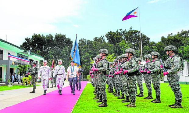
MILITARY FRONT-LINERS President Marcos troops the line during his visit to the AFP Western Command in Palawan. —PHOTO FROM FACEBOOK OF PHILIPPINE COMMUNICATIONS OFFICE
PUERTO PRINCESA CITY—President Marcos on Friday assured Filipinos that the government will respond to China’s “baseless” expansion of its invalidated claims in the South China Sea, prompting increased calls for the Philippines’ own “standard map.”
“We have received news that now, the nine-dash line has been extended to the 10-dash line. We have to respond to all of these and we will,” the President told reporters here after attending the celebration of the National Peace Consciousness Month in this city.
“We, of course, will continue to defend our territorial sovereignty, our territorial rights. We have not changed our approach. It is other countries around us that have changed their approach,” he said.
The President was referring to Vietnam, Malaysia and Taiwan, which disputed China’s expanded claims which was published in a “standard map” that Beijing released on Aug. 28.
India also disputed China’s inclusion of Arunachal Pradesh state and parts of Jammu and Kashmir region in Beijing’s new standard map.
Speaking before troops here, the President hailed troops of the Western Command (Wescom) for “holding the line” in the face of China’s harassment of troops and local fisherfolks in the West Philippine Sea.
He said Wescom has been vital in keeping the peace in the disputed sea and in the country’s territorial waters.
Also on Friday, opposition lawmakers urged the government to rethink its relationship with Beijing amid its “imaginary and baseless” expansion of claims in the South China Sea.
China’s propaganda House Deputy Minority Leader Rep. France Castro said the map “is part of China’s propaganda to justify its aggressive and militaristic actions in the West Philippine Sea and in the South China Sea in general.”
She said Congress should “strengthen our positions and counter China’s aggressive acts by filing and approving a map of our territories and exclusive economic zone.”
House Assistant Minority Leader Rep. Arlene Brosas also pressed for a “decisive pushback” against Beijing’s claims and “rethink its economic partnerships with China.”
Brosas said China’s acts of aggression in our exclusive economic zones “should be enough reason for the Philippines to stay out of this one-sided trade game.”
International maritime expert Jay Batongbacal of the University of the Philippines (UP) College of Law agreed that issuing its own standard map would help the Philippines assert its sovereignty in the West Philippine Sea.
“If we issue a map, it is not going to be self-serving, but rather it is actually going to be supported by the subject so your arbitration is going to be supported by international law,” Batongbacal said in an interview with ANC on Friday.
Batongbacal is the director of the Institute for Maritime Affairs and Law of the Sea of the UP Law Center and was a key person in the friendly, if lengthy, settlement of the country’s border with Indonesia.