


Image courtesy of Global Times
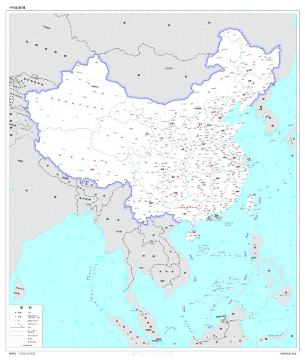
MANILA, Philippines — People’s Republic of China has released the 2023 edition of its standard map.
It now includes parts of self-ruled Taiwan and most of the West Philippine Sea.
A “ten-dash line” has been added to the illustration.
The image was released by China’s Ministry of Natural Resources on August 28, according to the state-run website China Daily.
China has put one new dash in the eastern section of the democratic island of Taiwan.
Beijing sees Taiwan as a renegade province subject to reunification.
Also inside this ten-dash line are the entire Spratly Islands, which include the Kalayaan Island Group (KIG).
More than 400 Filipino civilians, including 70 children, live in Pag-asa Island.
Pag-asa Island serves as the seat of the local government of the municipality of Kalayaan in Palawan province.
The Philippines already challenged the then “nine-dash line” drawn by China before the Permanent Court of Arbitration.
The Court had invalidated Beijing’s sweeping claim.
The 2023 edition of China’s standard map was officially released on Monday and launched on the website of the standard map service hosted by the Ministry of Natural Resources. This map is compiled based on the drawing method of national boundaries of China and various countries… pic.twitter.com/bmtriz2Yqe
— Global Times (@globaltimesnews) August 28, 2023
RELATED STORIES:
Anniversary of WPS arbitral ruling: AFP vows to defend ‘what is definitely ours’
Teodoro to China: Stop ‘invasion’ through harassment, structure build-up in WPS