from Pagasa website
The Hawaii-based Joint Typhoon Warning Center (JTWC) has classified “Mangkhut” into a supertyphoon as it heads to the Philippines.
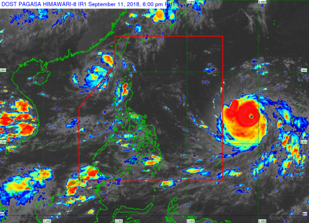
Mangkhut will be locally named “Ompong” once it enters the Philippine Area of Responsibility (PAR) by Wednesday.
An advisory from the JTWC on Tuesday said Mangkhut was packing winds of up to 250 kilometers per hour (kph) near the center and gustiness of up to 306 kph.
But the Philippine Atmospheric, Geophysical and Astronomical Services Administration (Pagasa) continued to categorize Mangkhut as a typhoon as of Tuesday afternoon.
It said that Mangkhut packed maximum sustained winds of up to 185 kph near the center and gustiness of up to 220 kph.
Pagasa measures the average wind strength of the weather disturbance every 10 minutes while the JTWC measures its average winds per minute.
Pagasa said Mangkhut was last spotted 1,650 kilometers east of Southern Luzon, moving westward at 30 kph.
Weather forecaster Aldczar Aurelio said Mangkhut will enter the PAR on Wednesday afternoon and storm signals may be raised by Wednesday evening.
The typhoon is seen to affect Northern and Central Luzon in the coming days. /kga