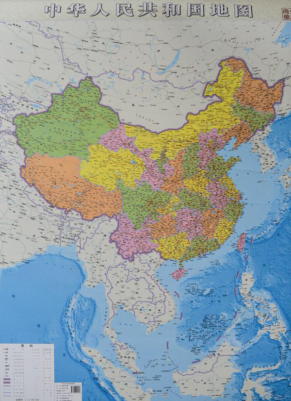
China’s latest published map shows its claim over the South China Sea by marking ten dash lines around the region just off the coasts of Vietnam, Malaysia, Brunei, and the Philippines’ islands of Palawan and Luzon. PHOTO sourced from China Daily/ANN
MANILA, Philippines — It’s just a drawing that has no bearing, Malacañang on Thursday said of a new map claiming West Philippine Sea as part of China’s territory.
“As a whole, to put it simply, they just drew that. All of these drawings have already been superseded by the United Nations Convention on the Law of the Sea,” Communications Secretary Herminio Coloma Jr. said in Filipino.
Coloma was referring to a map published by state-run news agency Xinhua marking China’s territory with ten dash lines drawn close to the coasts of Vietnam, Malaysia, Brunei and the Philippines’ islands of Palawan and Luzon. The said countries have been at odds with China over maritime and territorial disputes in South China Sea.
Coloma recalled that since the reign of Chiang Kai-shek and the Kuomintang government, the Chinese have been drawing lines to mark territories that are not theirs. He said it was an 11-dash line during that time and was replaced by the nine-dash line in modern times.
“You can’t base (territorial claims) on a drawing,” he said.
Coloma affirmed the earlier statement of the Department of Foreign Affairs calling the map reflective of the country’s “ambitious expansionism.”
But amid such actions, Coloma said the government will continue to pursue a peaceful, diplomatic and legal resolution to the problem.
He said the Philippines is still calling for the moratorium of construction in disputed areas and finalizing the Declaration on the Code of Conduct in the South China Sea that will serve as a guide for claimant countries.
Coloma also said they are waiting for the arbitral tribunal’s decision on the memorial submitted by the government, clarifying China’s claims.
RELATED STORIES

